
A walk through Benton Park - Reflecting back on year one
DISCLAIMER- the opinions expressed below are my own and the interpretation of the documentation is ever evolving. You are encouraged to form your own opinions or to agree with parts of what’s detailed below as they stand.
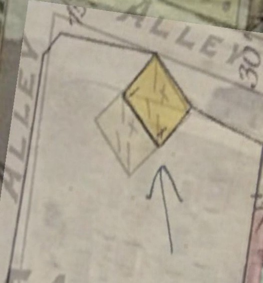
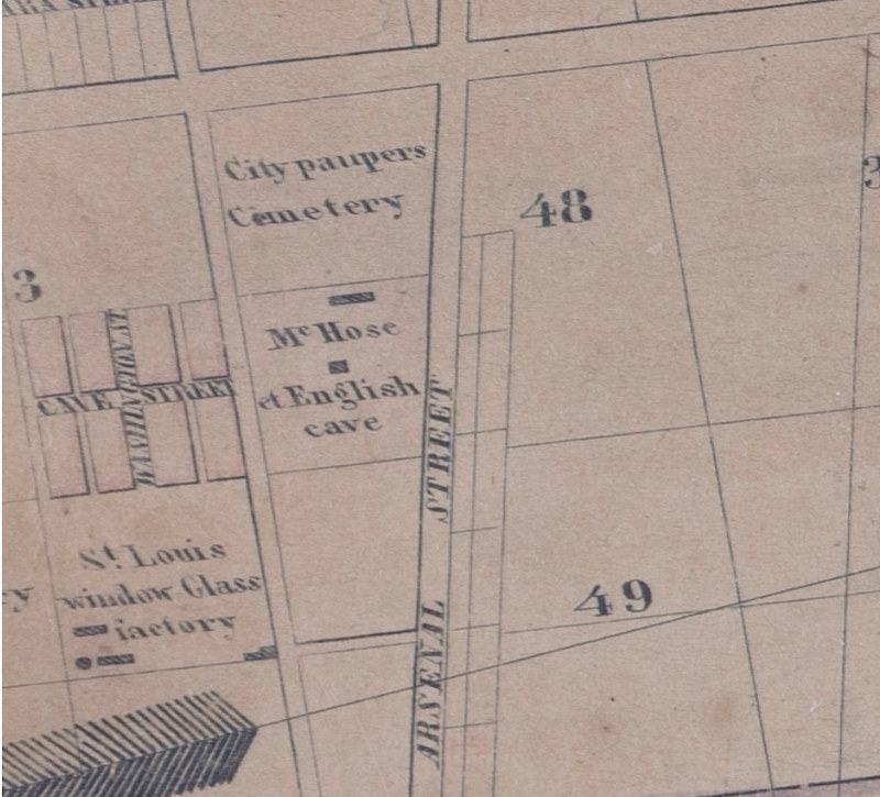
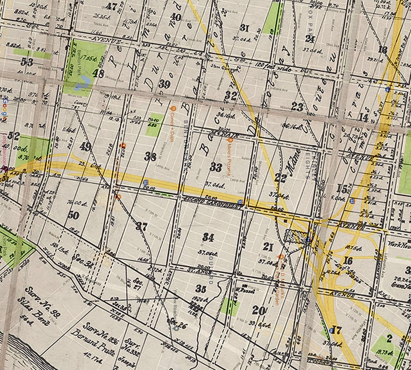
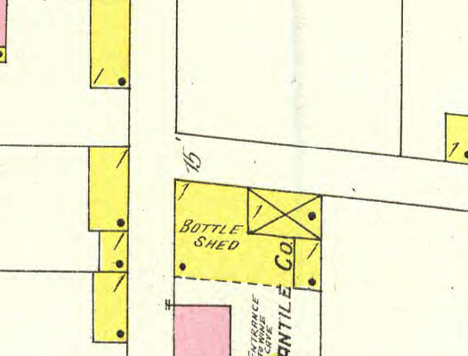
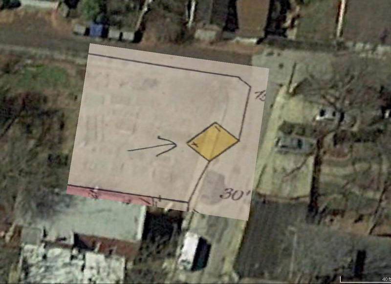
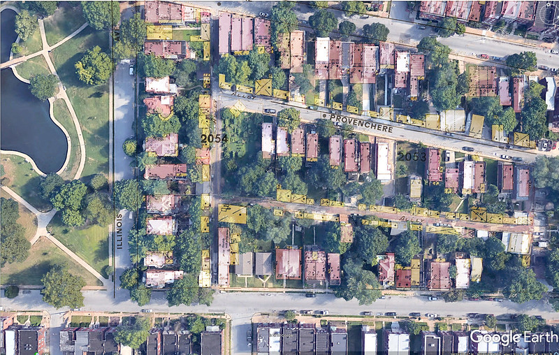
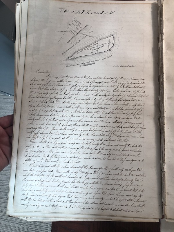
Provenchere Shed
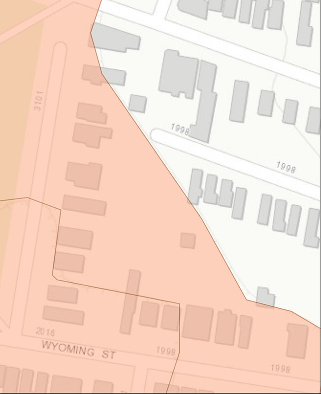
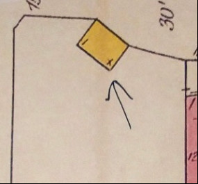
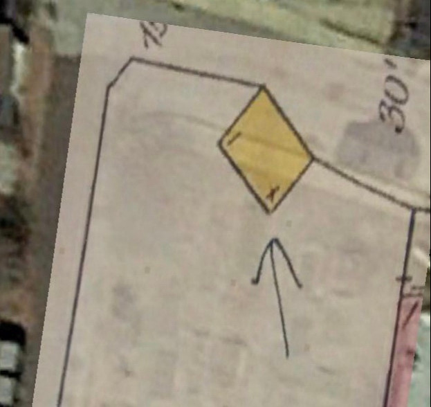
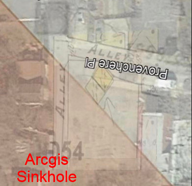
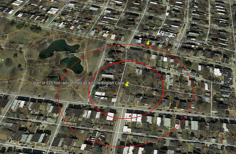
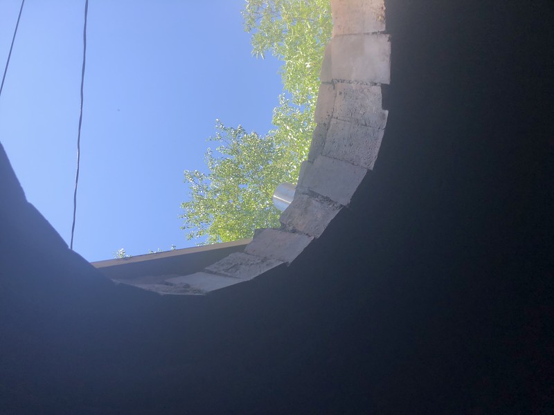
Welcome to the first leg of the tour. The 1898 fire insurance map shows a double frame structure. The 1909 map shows a single frame structure. We know from news clippings that Paul Wack lobbied with the city to save his shed that was once in the garden when the bond measure passed because he intended to sell his business. Opinion piece begins now. Something in this shed was of significant value, that’s the only logical reason that could be concluded as to why he lobbied with the city to spare his shed. The plans when Provenchere Street was widened also included upgraded infrastructure in the same general area mostly a storm sewer on Wyoming. At first glance it appears the northern part of the structure was demolished. A closer look actually reveals it was the other building that was torn down. Placement of the shed can only be presumed to have something to do with the DNR’s sinkhole area plugin shown below and that’s merging a ton of data to deliver almost useless info which is presented here now just to show the level of time spent on each item. While it’s not my place to suggest this was an entrance to the cave, it shouldn’t be lost on you that it’s the very first stop on our tour for a number of reasons and that’s one of them. Today’s layout places the single frame shed that existed in the map in 1909 in the middle of Provenchere. It would have been too easy for the city to leave a manhole cover in its place.
Single shed = 1909 Sanborn
Double shed = 1898 Whipple
Street widening = 1900
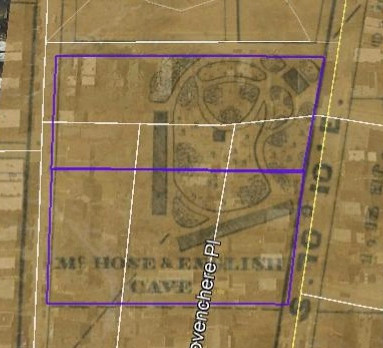
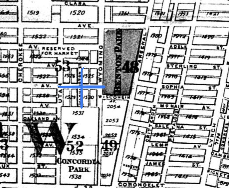
Park of Benton Park
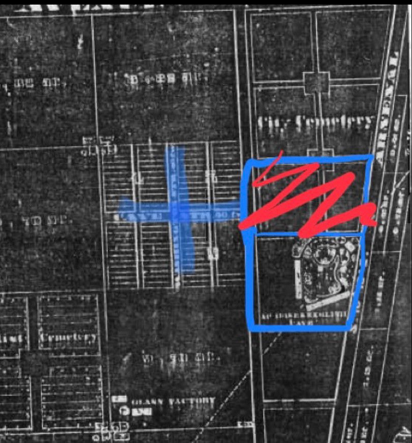
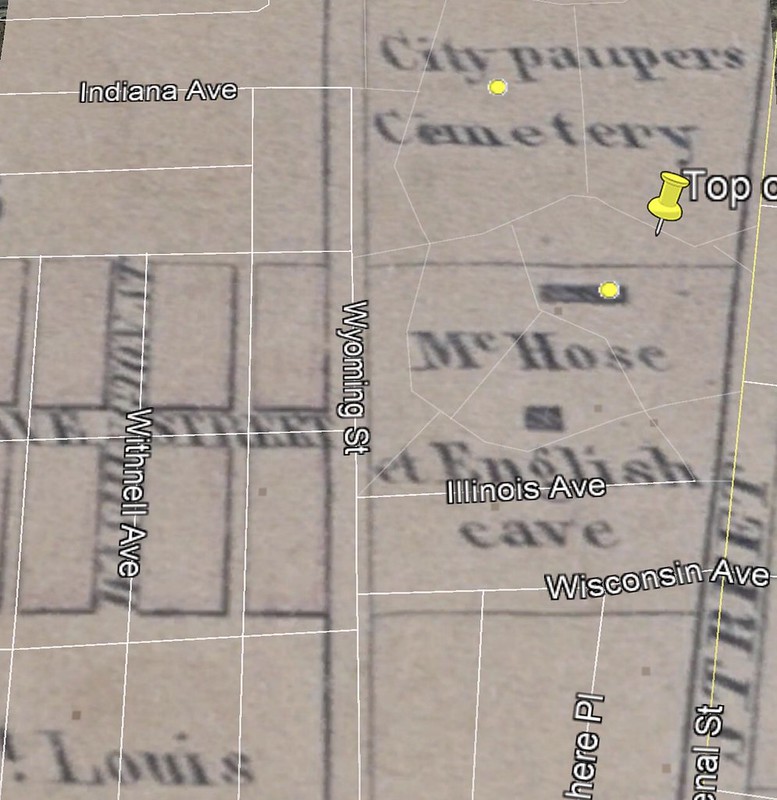
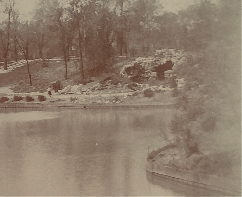
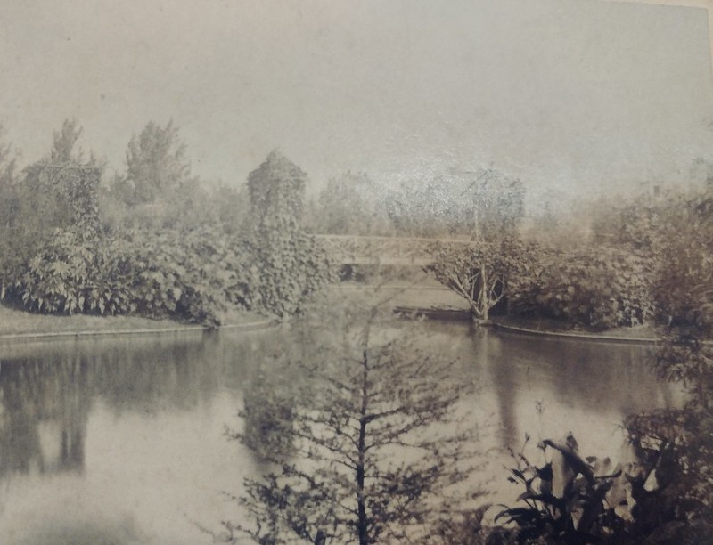
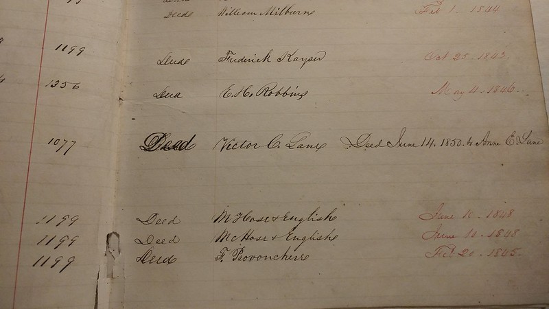
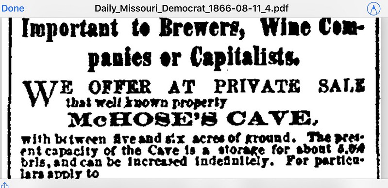
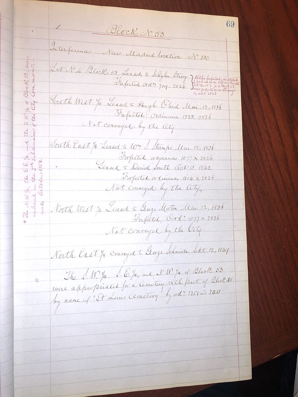
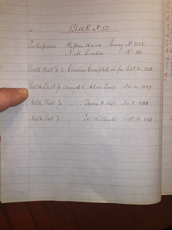
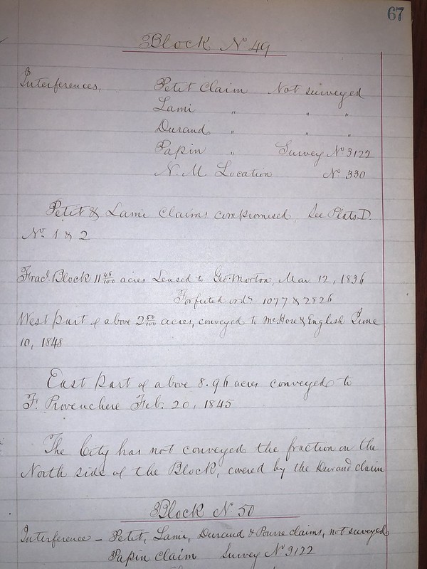
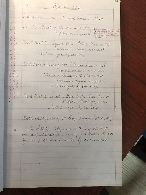
We now arrive at our next stop which is the crown jewel named Benton Park. This was occupied by Ferdinand Provenchere as the first leaseholder and was then re-leased to English & McHose. This property of the first lease covers the pond and the grotto. Overlay further indicates this claim due to a cemetery expansion. Opinion piece warning. Without a doubt there were separate tracts of land involved here that English obtained and the final number was two tracts at 2.50 acres each for a total of 5.00 acres. After everything I’ve observed I’m left to conclude from my own opinion that the westernmost tract of 2.50 acres was annexed by the city for the cemetery for expansion and English then obtained a new 2.50 acres on the other side of the tract they already owned sometime between 1841 and 1847. What made this possible was the city commons were a lease to own program. Once the term was paid in full the lease holder was conveyed the tract of land so long as it didn’t conflict with items such as the one mentioned where a cemetery needs space. The evidence is shown on surveys and when comparing the 1841 versus 1851 this definitely indicates English had buildings residing west of Illinois St in 1841 (formerly called Wisconsin). As tough as this is to follow my opinion is that English & McHose were once operating in what would be present day park property right around 1841 and the pond was most likely the area the two story frame structure stood that’s featured in the oil painting. I believe the painting direction was looking East from Jefferson and in the distance is what I presume is Provenchere St. The grotto and the incredibly ornate yet rustic original bridge were just not features one would expect to find in a paupers cemetery. The neighborhood wasn’t annexed into city limits until 1866. Further proof is that the area south of the park designated now as Illinois St was then called Cave St and the entire landscape of Benton Park is a giant land depression. On sinkhole plug-ins it is referred to as a sinkhole area but too large to be a single sink and is more accurately described as a collection of sinkholes within a large depression.

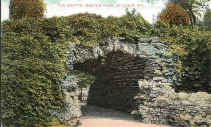
Grotto in Park of BP
All opinion based besides the next few sentences. Lafayette Park has what they call a grotto and it’s a sunken garden and pond. Forest Park has a grotto of another type altogether. Only one park has a grotto like this. It’s easy to think of it in it’s present form being more of a decorative not-so natural bridge design but that’s a commemorative design from when it was updated and rebuilt from scratch. From old postcards and photos, you see something peculiar. Rough hewn limestone barrel vault with no vertical walls on either end to enclose it. Awfully fancy structure for a paupers cemetery isn’t it? Almost looks like a beer cellar no? Perhaps it was part of the conversion to a park but it seems more like a pre-existing structure above it that had been razed at some point and this was what was left in place as a cool place to escape the summer sun. If referring back to the infamous oil painting the question is could this have been the location of the two story frame structure featured as the focal point in the painting titled “entrance to English Cave”? Was English & McHose in the cemetery that became a park? You be the judge. All I can do is put forward the most maddening info possible and pray someone gets all bent out of shape about it like I did. Oh and just to be clear the parks department commissioner submitted his expenses in great detail. No mention of masons laborers or hodcarriers existed. No lime and no limestone blocks either. All that can be definitively concluded is that no hint of any entrance existed when it became a park because the parks commissioner included in his report that he’d like to purchase the cave across the street for his department if the opportunity presented itself.
1841 Survey
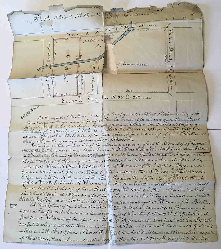
Shows “English & McHose’s Cave” with two buildings shaded in on the eastern third part of the of the present day park ground. That’s the complete other side of present day Illinois St. Also noteworthy since I mentioned Illinois St that this street was formerly called Wisconsin Street. One building is on the south side of the pond between the old bridge and old grotto and both have since been replaced. Another building is very close to (if not on top of) the old grotto. Rendering of image overlays deserve an accuracy rate adjustment of +/- 5-10%. I could have stretched the image to fit the structure on the survey onto the same spot as the grotto just to fit my narrative but I did this straight up instead with what I think the outline dimensions were.
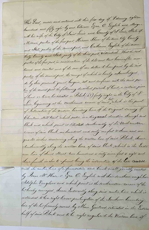
1843 Purchase

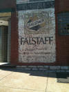
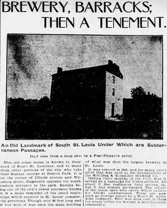
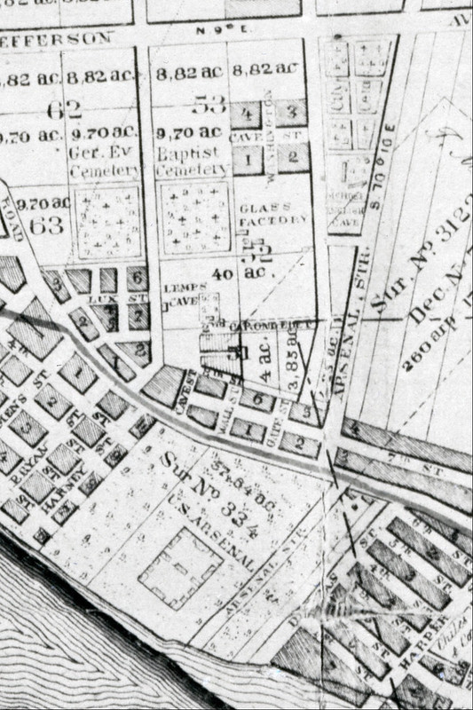
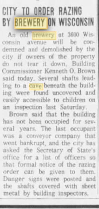
Schneider’s Brewery
It took me longer than I’d care to admit to figure out why my math was off when I was looking tirelessly through records for a six story building in BP that was torn down right before 1900. All I can tell you is that this is definitely the one and it’s a six story bldg! Who knew...
1838 Survey
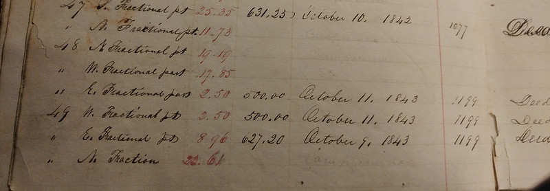
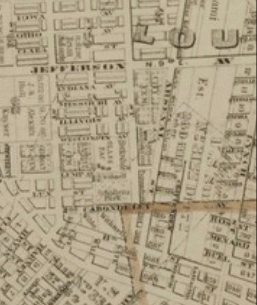
First mention on a map with the word “cave”. There is a symbol after the word and here comes a fair warning about an opinion based rant of mine. It’s my belief they sketched a crudely conceived entrance on the survey first to locate the right coordinates as the initial concern and then later wrote the word cave but didn’t leave as much space as they’d like to have between the two since writing left to right up against the symbol. Most agreed with my assessment but not all did. On this survey we also see what appears to be English's wagon trail down to Broadway. His brewery was near the south side of the PSB. About six blocks south from it actually. Horse and wagon’s with cargo traveled at an average speed of 2 to 3 mph on rural roads like this. Round trip from brewing location to cave was 2.3 miles measured using trail. An hour to and another hour back without including time for loading and unloading the hogshead. Add in precipitation and you can double that time because this requires an uphill/downhill element to it as well. You’d be lucky to brew two hogsheads worth of beer per day and it would be a very long day at this distance even if you had a full time brewer to stay on site at the brewery, it was still a grueling journey to travel this way. Instead of pontificating on what I think, I pose the question to you instead. Let’s say you are the owner of the St Louis Brewery and the year is 1842 which is when the 1838 survey was published. 100% of your income is generated by direct sales to end users at your own drinking establishment. Wholesaling to bars and taverns hasn’t been invented yet, and while those type of establishments exist they are all owned directly by breweries and every one of them competes with you. Your revenue depends instead on keeping up a family atmosphere which is also part of your success at English’s Cave. You are booking orchestras and marching bands and organizing meat shoots and looking for newer gimmicks all the time like hot air balloon rides. You seek out local groups to cater to when they aren’t filling the place on their own. You get into food sales as well to keep customers there longer. You also must brew beer when you can. The question is are you a true brewer or more of an amusement park operator? Without taking anything from him as a brewer, it simply wasn’t in the English family heritage like many of the German powerhouses had to their benefit. I don’t believe for a minute Ezra geeked out on hop talk. Beyond that the English family didn’t start the St Louis Brewery, they purchased it and improved its business model significantly with the park component. With each new decade in the 1800’s the competition swelled and so did the innovations in the industry. Ezra passed roughly a dozen breweries on his way to the cave from his brewery and then again on his way back which had to make him feel as if he was in an antiquated business model by the 1860’s if not sooner. What began as a decent sized market with only a few competitors swelled into being ground zero for beer capital USA in just two and a half decades. This survey shows the most primitive look into what the cave area of Benton Park looked like but it was very much a rural area and was known at the time as St Louis Commons. From the time the surveying began in 1838 to the time it was published and approved in 1842 Ezra English & Isaac McHose established a 15 year lease term and within a few short years paid off the term of the lease (2 plots of land @$250 each) which resulted in a conveyance of the property to their ownership. Basically the city ran a rent a center type program with commons land. The program was set up because there were some 10,000 land claims from both French and Spanish origin prior to the Louisiana Purchase. A special court was also established to hash out who had a legit claim to the thousands of colonial land grants that should be recognized going forward. Ironically when St. Louis was founded in 1763 Pierre Laclede’s team began clearing trees to establish a trading post near the confluence he named his settlement after the king of France. It wouldn’t be known until years later but the French king had already struck a deal with the Spanish king involving the territory that included St Louis. So the Spanish king begins handing out land grants and because the king of France double crosses him, he does too. As for your old buddy WhitePanther, he’s still devastated that his own ancestors didn’t bother to ask either king for a piece of the action but I digress. You can see the name Benito Vasquez in that survey when viewed in full and it was mostly commons and his land was in what’s known as Benton Park West on the other side of Jefferson which is a curious layout by way of its survey markers most likely following land features at irregular angles which is common for rural property even now (creek or river or etc). The point is it can be more or less inferred that Vasquez was one of the few who’s land grant got approved. Fun fact. Vasquez also had another claim rejected in which he filed a claim for 10,000 acres in St Charles Co. This story illustrates how big of a mess St. Louis had to sort out when President Jefferson purchased the territory.
1851 Survey
Shows English & McHose’s Cave with a small building very near this symbol on the other map. Two other longer buildings are arranged in a very strange layout which almost looks like a crudely arranged baseball diamond infield. Home plate if you will would be jammed up near the corner of the intersection. One building is sitting on Provenchere and another is stretched out over Wisconsin. They aren’t situated on angles in relation to street that make any bit of sense until factoring in historical land elevation before the sinkhole area was altered with fill dirt. There are members of the group that believe the longer structures were not frame structures but something more like large canvass covered timber frame style beer halls. WhitePanther happens to be one of them. I’ve gone back and forth on original purposes but I think they could have been somehow associated with an overflow for the barracks at the Arsenal and/or mess hall accommodations. It’s been confirmed that in 1862 the operator who took over for Ezra as he headed to war was advertising a guaranteed rate of 3 square meals a day for soldiers at a rate of no more than .25 cents per day which is where I derived my suspicions about what it was in this we were seeing in this survey nine years earlier.
Surveyor’s Abstract
Surveyors had different interpretations of survey markers from one to the next. In some cases so did the same surveyor from year to year. 1843 & 1846 was done by the same guy and he uses totally different sides of the same building for English as a marker for US Arsenal/English property line. He takes this to the north of Cave St (Lemp Cave) one year and the centerline of Cave St. another year. So J.H. Fischer I’m just sayin - I see you though.
Proprietors
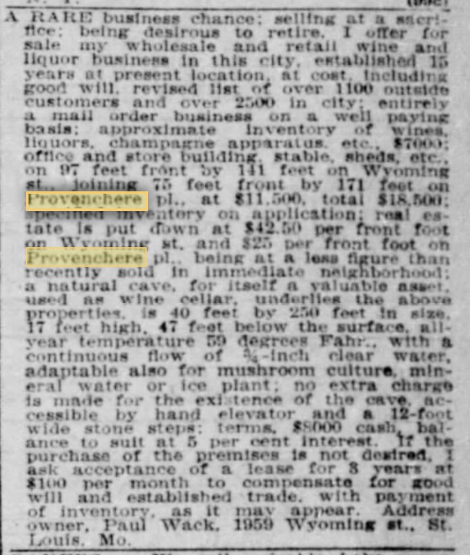
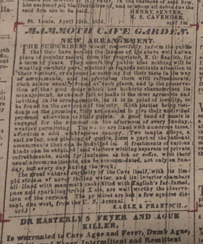
It was just the thing in the 19th century. In the 1840’s English does a bunch of work above and below ground and officially name the joint Mammoth Cave & Park. Another nice name to try and research but I digress. Despite the name, newspapers & directories called English’s Cave anyway. Surveys and maps called it the same except when it was titled English & McHose’s Cave. Point being, even when Ezra leased the cave to Karl & Praetsch it was still English’s Cave. Paul Wack by comparison didn’t ever call it by this name and it wasn’t until his estate became desperate to sell after 1912 that any of the ads placed dating back to 1900’s mentioned English. By 1912 Wack was either deceased or very near death in California where he relocated after a publicly humiliating divorce. The whole period of time with Mr Wack is rather curious. Much is yet to be uncovered about Wack’s underground descriptions in his classified ads that didn’t make any sense and those won’t be fully explained until English has been re-opened.
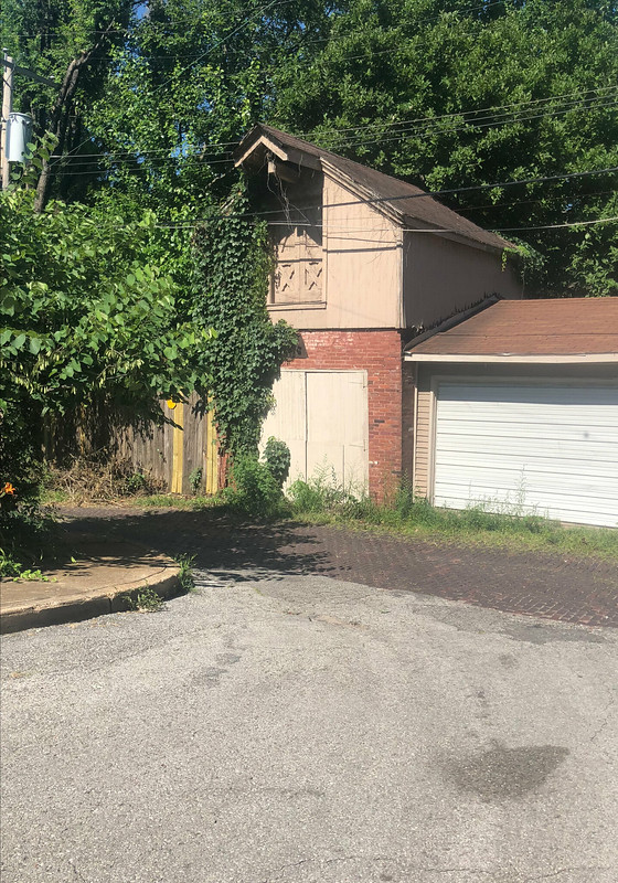
Wack Bldg
It was built in two phases. First phase was approximately 20’ x 20’. First off that’s awfully small. This was where the front third portion of the building lies today. Then the second phase was built in 1895 which is when we see the outside eastern features of an entrance to the grotto as shown on fire maps. On Whipple and Sanborn they call it different things. One is a hoist. The other is an elevator. Plausible opinion time. The conventional wisdom after everything I’ve researched was that it was possibly a hand operated elevator. There’s not enough known to There’s a sign on the front of the building now. It’s on the lower left when facing front. That sign sits on what appears to be an old coal chute. It’s cemented over and solid which is a very common distinction in this neighborhood. It’s generally got either an arched or rectangular shaped doorway looking feature built into the foundation that’s been bricked up as well. When heating sources changed from coal to oil (or natural gas) these caused way too much of a cold air draft and it was also too big of a security breach which is why they were usually sealed off. Once upon a time there were a few scattered BP residents who thought they might have had a former entrance because of these odd features and honestly who could blame them. The strange part about this one though is that the later ads of Wack selling his bldg gives dimensions of the building (upstairs dimensions). That’s not out of ordinary. But this is Paul Wack and everyone who sees the inside of this cave from the minute he became the owner of it ends up going batshit crazy so of course he gives basement dimensions too. It’s shorter in length in the basement by 17’. No clue as to why. Definitely not suggesting any conspiracies and I’d ask all comments about the Wack bldg be respectful. No reason to believe they wouldn’t be.
Sensitive Wack Issue
Many many years ago there was a guy some of us know who had permission to poke around in the yard of the Wack bldg by it’s owner. The remnants of the old vertical shaft were positively identified and he confirmed it was filled to the top instead of just covered across the top with a steel plate like some cisterns are when taken out of commission. Whether it’s because Lost Caves was re-released as an anniversary edition or because a new generation learned about it on here doesn’t matter. There’s been a long history of suspicious activity and/or trespassing at the Wack property. Whatever you might want to know about the bldg could be talked about in greater detail here than anything you’d learn while trespassing. Also because this deserves mention I’ll state the following based on nothing but an emotionally charged opinion. If money were no object, and if things didn’t go as planned at the garden the Wack Bldg would not even be my next favored location to try to unearth English. You might have noticed Wack’s building address changed from 1900 to now. That’s because he or his estate subdivided his land into different parcels. The part I want to highlight here is that the shed width stretches out over the property line. It had to be razed in order to subdivide property.
Wack is Wack
Opinion rant. Where do I even begin. I swear everything attached to this cave’s history is so convoluted that it’s just crazy enough to keep my attention when it shouldn’t. So here it is. There were two Paul Wack’s. A Sr & a Jr and neither one of those extensions appears in 99% of the articles. I have some personal opinions on Wack that I’ll leave out of this. His wife however she was definitely a hussy and let’s not kid ourselves it’s always important to call a hussy out for accuracy. The hussy had a newspaper article dedicated to the affair she was engaged in with a man on the same block which was humiliating to her family. Just prior to this the hussy posted an ad in the classified section for a young girl to do housework presumably to spend all her free time hookin. Then my man Paul Wack finally makes me proud when he learns of this and he posts an ad himself looking for a young girl for office duties presumably to tell the hussy she can be replaced. We first learned about the second Wack from deed info at city hall. One oddity about the classified ads to sell his building makes reference to air shafts. Heavy opinion rant. When windlass equipment is rusted out and broken and you wanna sell then you just pull em out altogether and poof. Got yourself an air shaft. There couldn’t have been a need for an air shaft because caves breathe and bad air isn’t unheard of in a cave but I challenge anyone to find the contractor and the year that drilled an air shaft. It didn’t happen. As for Paul Wack Jr he had a rather colorful decade during the 30’s. One homeowner reported him to be what they thought was a prowler, when police arrived they were surprised to find that his car had crashed through their house. Then in a workplace incident while horsing around he is pushed into a set of elevator doors. The two men fell down the elevator shaft and Wack Jr broke his back in the fall. Then Wack Jr sued the elevator company for his horsing around at work because the doors should account for that or something. Unbelievably in an era where such a thing was unheard of to litigate he was awarded $40k. This is the last peep out of him publicly.
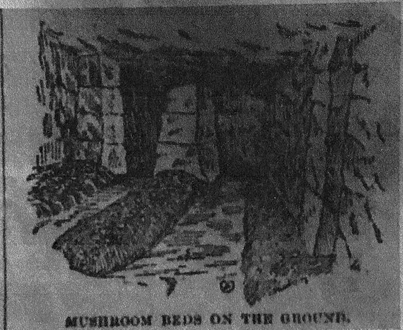
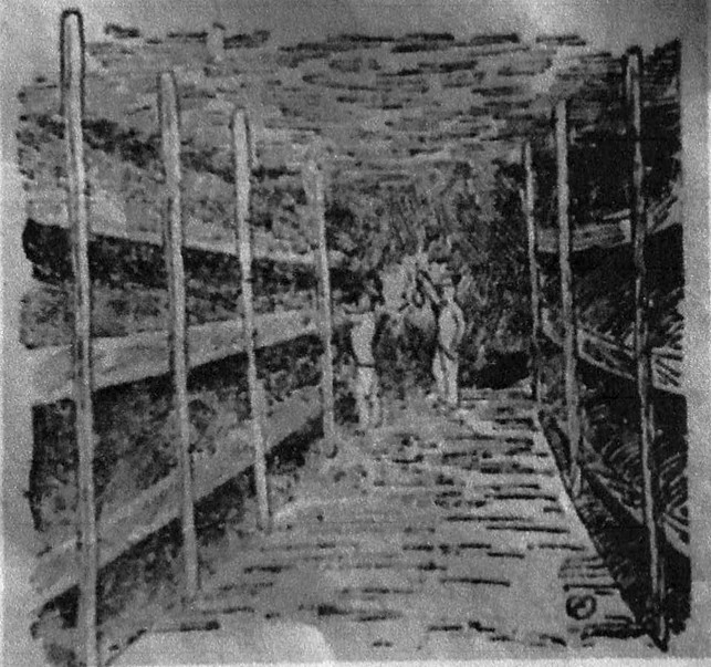
St. Louis Cultivated Mushroom Co
This one is wild. And not entirely cited yet but they purchased the entire grounds once known as English which would later be known as CB 2054. Then they begin subdividing lots. Selling directly to Stutz, Vortriede, Schollmeyer, etc and those individuals become the new neighbors (many of whom at this time are upper management figures at local breweries but because this was to be a high value district not bc of conspiracy to tunnel into English). Some of these same names are announced as capital investors for this operation in late 1880’s and the business entity STLCMC has one full feature article prior to this detailing an outrageous harvest rate described as 60 lbs per day. That’s a shit ton of mushrooms and quite possibly a lie. Maybe that’s how they got investors? On the chronological timeline the last peep out of St. Louis Cultivated Mushroom Co is that they incorporated with $25k in stock with new partners Stutz Vortriede, and other residents and they disappeared right after. That was the last peep until the same company name pops up a whole 10 years later. That info is in next header but during this time period we finally see the very first sketch of English. Drumroll please.......
English Cave Garden
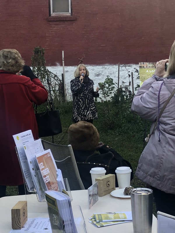
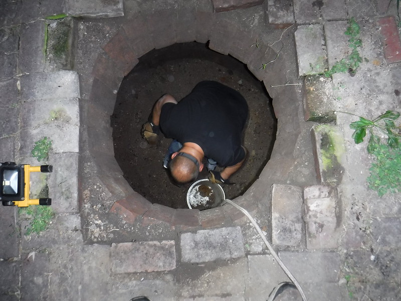
Another gem of a story. There are deed records at city hall showing a building permit that we obtained and it says construction began but was never completed for a home. I have opinions on what this was and I happen to be right on this one but those are pointless to the story. The permit dates back to the 60’s. It didn’t become a garden until the plot of land ended up in the city’s LRA land bank. The Benton Park Neighborhood Association thanks to garden co-founder Wildbill999 became one of the city’s neighborhood gardens around 2006. Wild Bill aptly named the property The English Cave Garden. He served as co-chair for twelve years until a clerical mishap occurred with renewal paperwork and by the time it was discovered, a fellow neighbor from the neighborhood had an offer on the property to build a spec home. This all went into motion just two months after I met Bill for the first time in November 2017 and ironically the threat to build on the garden grounds was the same event that turned into the English Cave Steering Committee. The family who put in a contract offer on the land was putting on one of these productions is the best description I could give. When prodded about building a spec home for profit the man of the family replied that he was building his dream home on a lot that faces alleys on three of its four sides. Little did he know who he was up against. Wildbill999 has a ton of experience with theatre and video production as his long time labor of love and when dealing with something such as this at City Hall it takes someone like him to put on a live production at the podium which he did in heroic fashion. The building department agreed that there was enough concern to commission an ERT test. Chris Naffziger from St. Louis Magazine came and interviewed garden members and got the pressure from fellow citizens amped up about the garden being in danger and this event was one of the more critical moments on the timeline in my opinion. By spring of that year the test results were in and as our own Wildbill999 put it the bidder caved to the pressure when test results positively id’d karst features underground. By summer of that year our regular meetings were in full swing and at this time MVG’s Joe Light obtained the ERT results via Freedom of Information Act request. Summer of 2018 also presented us with a unique opportunity to dig up a cistern three houses from the garden and the significant result of doing this was keeping activity nearby which helped win some trust with other neighbors by being around more often. We each took turns paying for the dirt collection boxes to store the contents of the cistern. By October of this same year Mayor Krewson was at the garden to commemorate the residents of Benton Park for their hard work to save the garden from development. That next month in November one year to the week after meeting Bill for the first time, the Benton Park Neighborhood Association officially closed on the garden.
A Shed
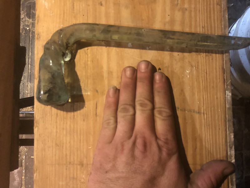
Which shed remains in debate but there were two notable ones. The Provenchere shed and the Wack shed. We know for a fact that there was one shed with both a windlass and steps. We haven’t the slightest bit of facts to indicate which building it was. It’s steps weren’t detailed for a number or type of construction but were apparently of an extremely steep pitch according to newspaper articles. The windlass of course is an open pit hand elevator since it’s inside. These two things existed inside of a single structure for sure. This structure definitely predates him being involved with the cave. I’m just sayin it was the Provenchere Shed and that’s based on an 1888 article before Wack was on the scene. It's important to point out what 19th century windlass is, in case you don't know. I didn't and my friend google helped. I'm guessing it's the one to the right.
Two Story Shed Wisconsin
It’s really difficult not to look at this thing when on the street with suspicion. I’ll be clear it’s not the right placement or orientation to be the frame structure in the oil painting. It can play tricks on you though. You don’t have to use a whole lot of imagination to imagine this building in the oil painting. I do not believe it was constructed until after 1890 and only as a residential barn. The most unmistakable feature of this building is a large beam at the top center of the joists. It extends about 3’ from the building and has an iron hook attached. Just below the beam is a door or hatch. It could be a hay loft with a fire company hook for the hook and ladder to pull the building down in the event of fire which used to be the way to prevent them from spreading. Or the hook could have been for load bearing weight to use with a block and tackle. This building like the Wack bldg and everything else in this saga is all a battle for the mind. It’s a trick.

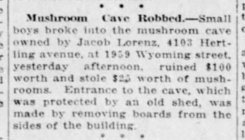
Wack Bottle Shed
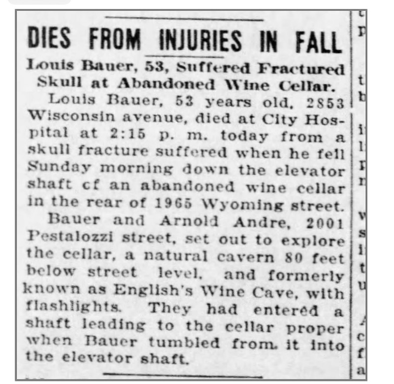
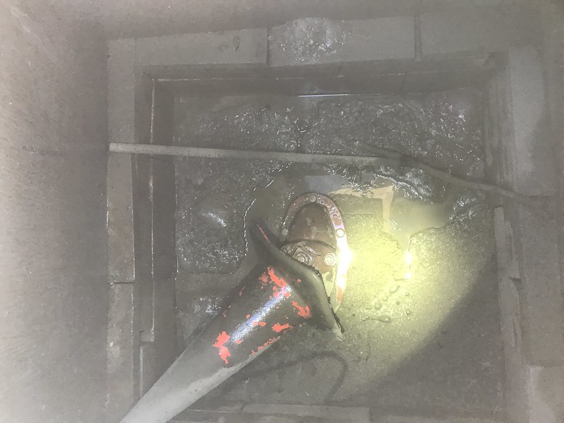
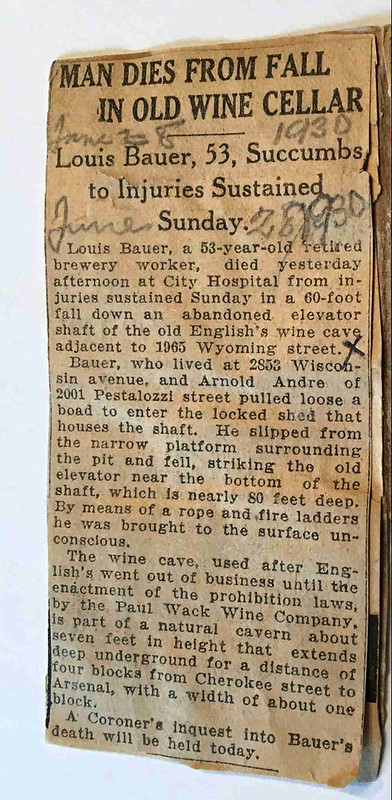
It wasn’t designed to be a traditional shed. It didn’t appear from maps to even face the alley. It did have a windmill for raising water we presume since that was the traditional use of these. I call this a bottling shed because that’s what Whipple called it. Wack never says that phrase in any advertisement for all the years he attempts to sell. He mentioned stable and outbuildings and uses the term shed. 3/4” is used to describe the spring which is odd if describing anything but a pipe size that feeds this supposed stream. A 4” pipe is mentioned as well but doesn’t mention what for. Seems to be a drain for the spring. Plausible opinion here and I’m just being honest. That sewer would have to be over 80’ deep from street grade to allow for a gravity drain and it seems more likely that it would drain to a sealed off section of English. Not sure what year it was razed. It’s not visible in 1953 aerial pics but was there at least up to the death of Louis Bauer in 1930. He reportedly entered the building by removing some boards off the side of the shed. I believe he may have been attempting to operate a hand elevator or was possibly unfamiliar with windlass equipment. He fractured his arm and skull and died the day after. Across the alley we got a lot of anomalies that showed up on the ERT Report that to me hints at the possibility of a staircase but that’s to be taken lightly.
GET THESE PICS OUT OF PRIVATE DOMAIN FOREVER


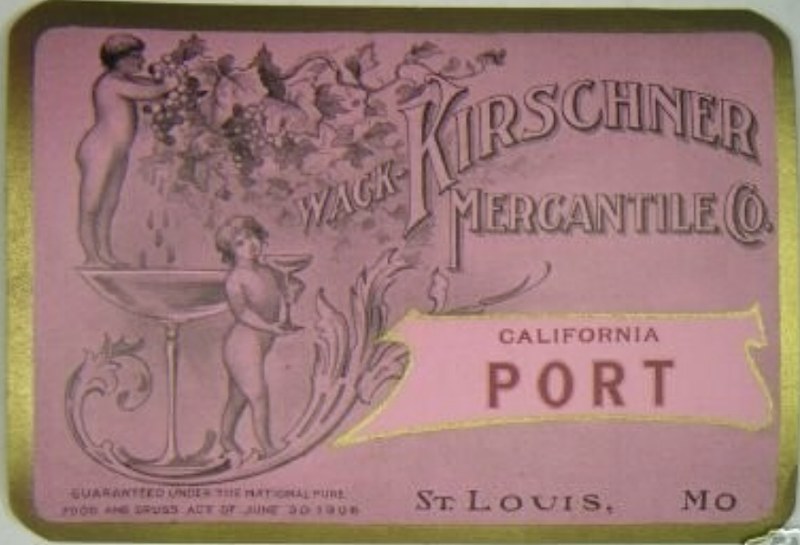
Wack Wine Label
Schneider Brewery Demo (later Shepherd School)
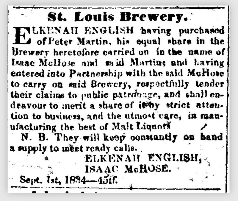
1834 First Date English is known to be associated with St. Louis Brewery
Mammoth Cave
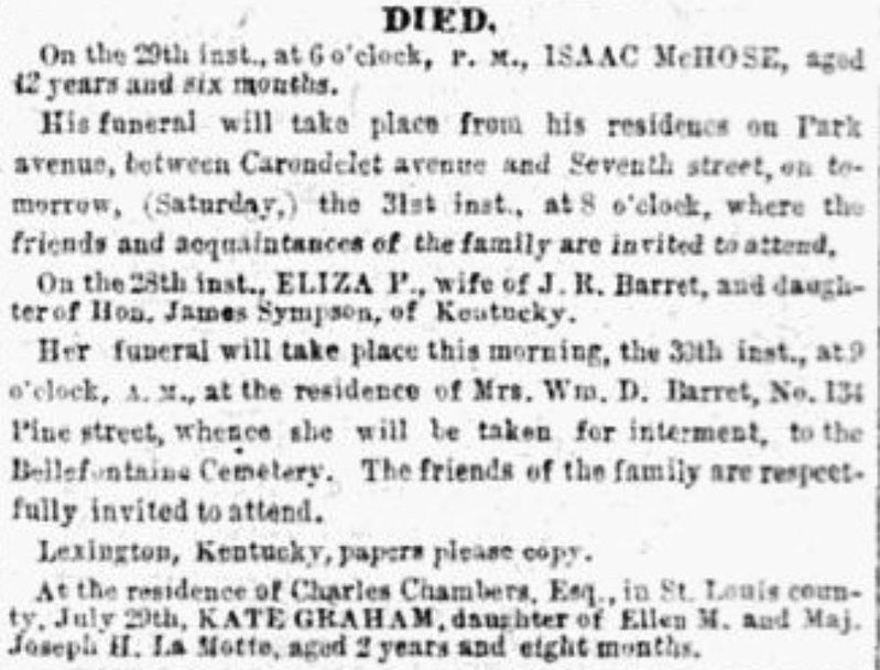
Isaac's death was odd. His first attempt at suicide was reported to have failed due to the fullness of the knife. He almost certainly suffered from what was then considered a situational or long term personality disorder called melancholy which today would usually be considered depression
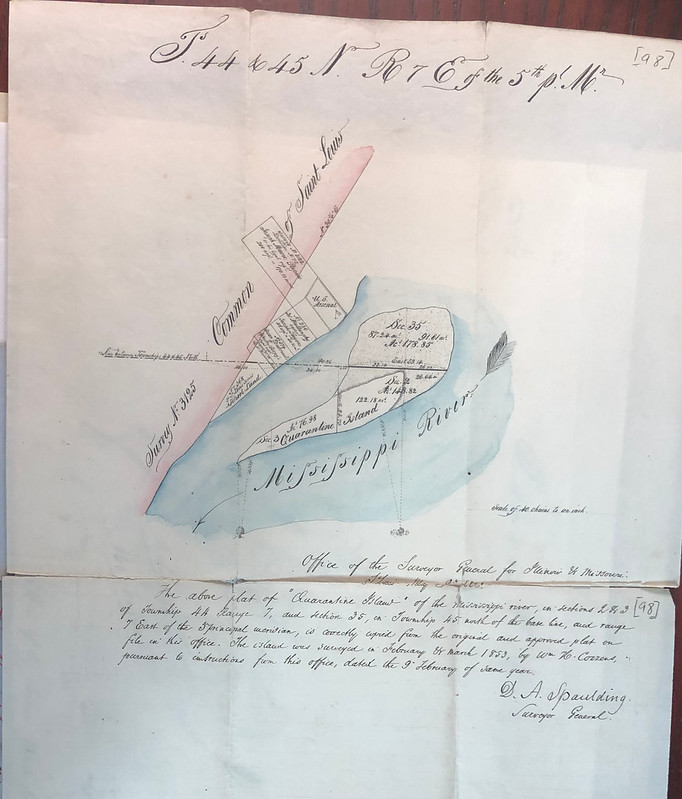
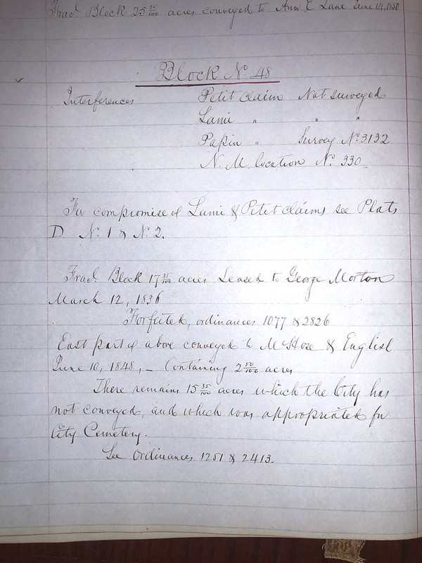
1863 first legal description of property shows 5 acres owned and 7 acres leased (7 acres is in park)
1841 Survey (see where Cave St intersects)
Plat Map (now see where Cave St intersects)
1866 first mention of sale
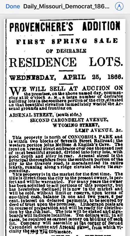
1866 Provenchere's Add'n
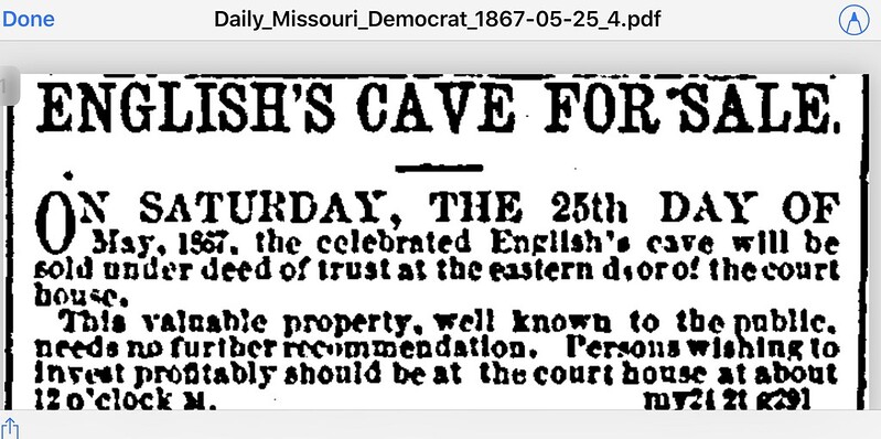
1867 next mention of sale
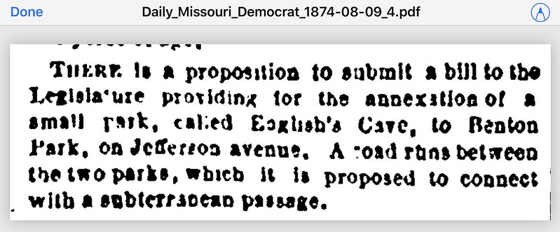
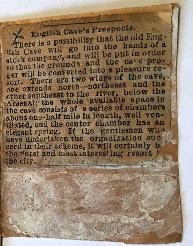
1874 Proposition to Annex Cave
1912-1920 Wack Sale
1880's English Cave Robbery (mentions means of entry)
1930 Death (also entered by removing boards from side of a shed)
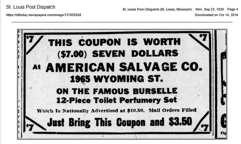
1929 Salvage Co Years
Circles represent target area of the two most cited cave lengths but for all intents and purposes 255’ is the number to beat
Overlay 1909 Sanborn
Mayor Krewson Ceremony Oct 16, 2018
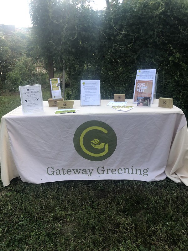
Gateway Greening Council Land Trust Org
Shutoff for pond feed
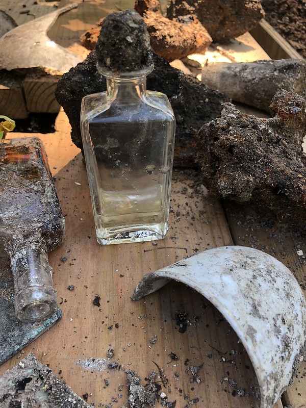
Cistern Dig
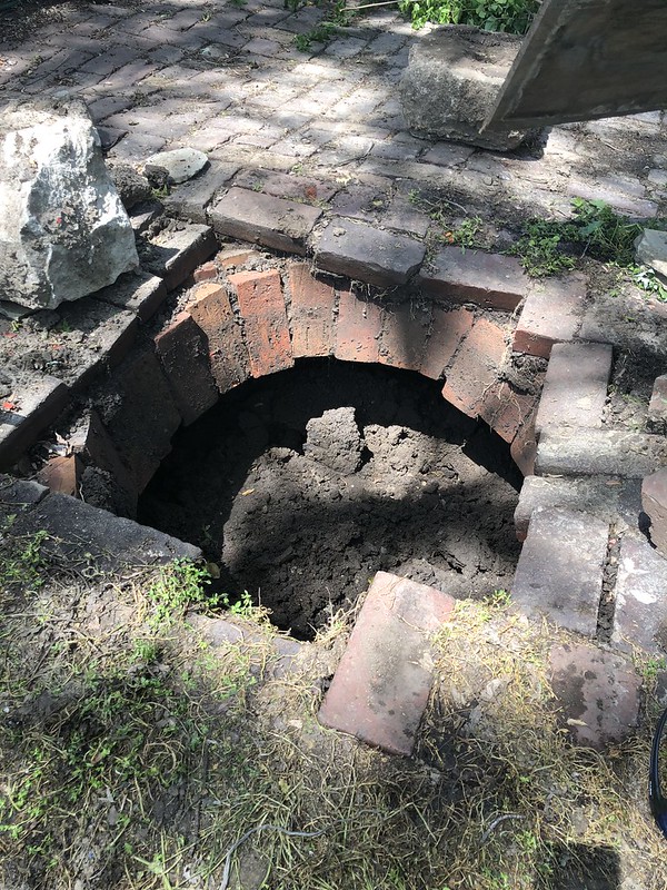
Cistern progress
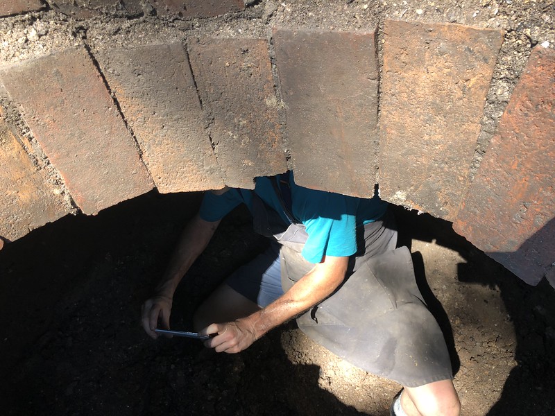
Cistern score
Cistern looking out
Cistern score
Cistern score
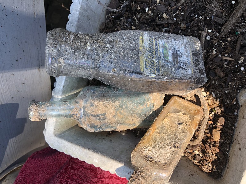
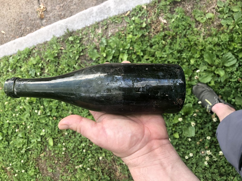
Cistern score currently at 37 bottles

Interesting item recovered
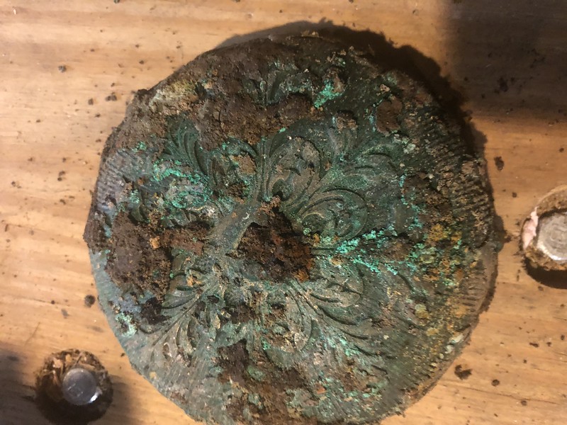
Another interesting item
English Cave Test Dummy
Cistern bottle cleaned and illuminated compliments of Surefire

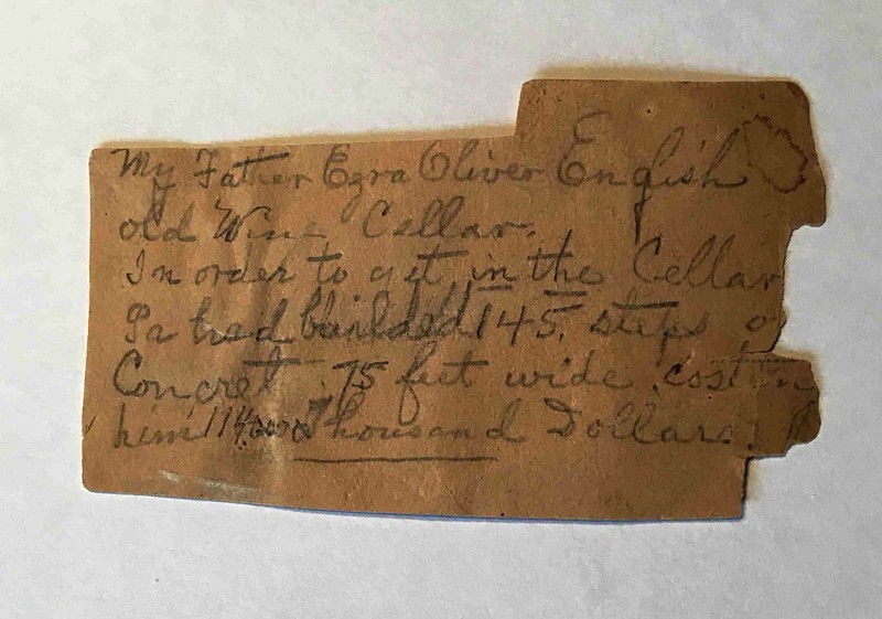
Ezra English’s great great great granddaughter's files. This first note is fascinating yet I will recount what Mrs Ryan’s husband said when he saw the look on my face for clarity. He said it didn’t make any sense to me either because it’d be 3 million in today’s money.
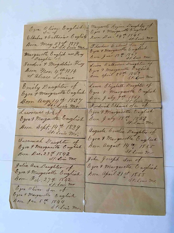
Deed for E.O. English Estate on 3rd St. In my opinion there's a page missing. Possibly a page pertaining to the cave in Benton Park. Go figure.
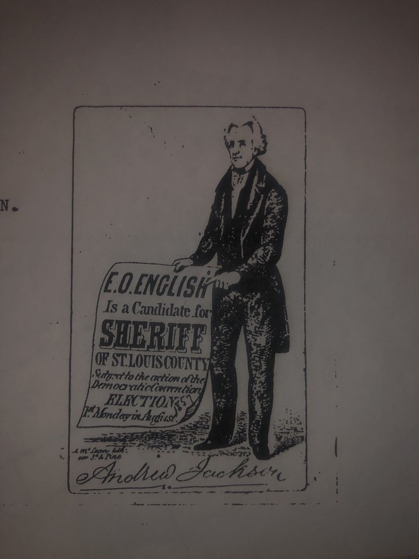
The back reads Spent $500 on election, lost by one vote
Schollmeyer Bldg
If these walls could talk? As luck would have it the building at the corner of Illinois & Arsenal was for sale during year one. This was the site of a beer garden on the southern side of the building according to the 1898 fire insurance map. When studying the city’s GIS data many of these land plots that were developed in the 1890’s along this block do not match up with actual property lines as they exist today. In fact the southern side where this building sits was to be another subdivided plot of land for development. We were not able to gain access to the basement of this building but one member of our group had been in it. There were a few MLS pics from the sale that might still be floating around the net. Now for the truly insane. One rogue realtor’s description of the building placed this as the site where MLK’s assassination was plotted out. While it’s true that James Earl Ray’s brother was a tenant renting here during that timeframe, it would have been the very first place authorities would have looked for him after his escape from Missouri’s State Penitentiary in Jeff City. Opportunistic as it might be that’s still quite the allegation to say the least. I’d be surprised if James Earl Ray spent more than a night here and the FBI actually placed his last known whereabouts prior to the assassination in a hotel room in California. Christian Schollmeyer was the original owner of this building which is where it got its more affectionate name by us. He was a grocer and from the looks of it also operated a beer garden either directly by himself or by leasing space to a third party we don’t know. Opinion piece. The 1838 survey is very close if not the same location as the southern yard of this building. That entrance would have been the natural entrance to English Cave and whether it’s on these property lines or not is open to interpretation. What’s known is that Paul Wack and Christian Schollmeyer had simultaneous periods of ownership for nearly 20 years of their respective properties. In that period of time Wack never once refers to his cave as English Cave. It’s highly likely that Schollmeyer is very close to if not on top of the northernmost part of this natural cave system. This writer does not think the cave was ever accessible from the basement, but remains suspicious of the outbuildings shown on fire insurance maps as potentially being a man made entrance. Mechanical cooling first became available in the 1880’s but it was only very large commercial operations who had access to it for years. If still running a smaller operation such as this a cave would be sufficient for cooling beer in the 1890’s. Paul Wack was the owner of the only publicly known cave in Benton Park and his cave was continually listed in ads as being 40’ wide by 255’ long which was probably pretty accurate but those dimensions indicate a strong likelihood that Wack made partitions underground during his ownership that didn’t exist beforehand. 255’ length is ironically the exact distance between the Provenchere shed and the vertical shaft next to the Wack bldg. 40’ is very close to the eventual width of his above ground property lines after he subdivided his property into two parcels. The Wack bottle shed also overlapped the two properties which would have had to be demolished prior to subdividing. I’m not qualified to say how Wack ended up with such a small portion of the natural cave system but common sense leads me to consider the potential alterations were made prior to the sewer infrastructure upgrades that occurred around 1900. The motivation for sectioning off Wack’s cave from English would have been to keep out sewage orders and overflow from the combined sewer system that created serious issues for decades to come. Schollmeyer might very well have ended up with a yard on the southern side of his building that wasn’t intended to be his by the developer Vortriede simply because it was deemed unsuitable for development of a high value home by builders. English Cave undeniably rests in portion under the garden and the Wack bldg and the Schneider bldg and the park. It also once spanned the distance all the way to Cherokee St. As we hang a right from Arsenal to Wisconsin we reach our final destination.
English Cave Garden
We finally return back to the beginning of our walk around Benton Park as the last stop on our tour. Year one had many unexpected twists and turns. One member of UO who doesn’t want to be named walked into his first meeting at the end of year one and casually handed Bill the current address of the recent widow Charlotte Rother. The group (or more accurately Bill) sent her a care package that Christmas that she received the day before Christmas Eve just after visiting Hubert’s grave as she later replied. It included an overview of our mission and some questions we hoped she might be able to answer. She replied graciously and described her amazement at the irony and sense of pride she took in knowing Hubert’s passion was being passed on and how happy he’d have been to hear the news and she put us in touch with some surprise contacts afterwards. As year two began in early January today’s tour guide had long neglected some much needed projects at home and got lost in English research for too long so I notified the group of my intentions to step away and there were many reasons for this. First being that some of my conclusions that were entirely opinion based expressed during year one as well as my view of how to proceed were a risk that could be very distracting to the mission looking forward. To myself I blamed me for losing site of the fact too often that this was now BPNA’s baby now and I served in a volunteer role they didn’t ask for and even made what I felt was likely a nuisance of myself from time to time in correspondence. The next day after resigning internally to the core group leaders I then get asked by them if I’d like to come along and meet the English descendants and view their family archives. Later that week one core member of the group assembled the entire collection at the MHS of the St. Louis Commons records and left them on a cart for us to study. I participated from that point forward only in what I thought I could be helpful with and did make good on my promise to reduce my role but didn’t quit entirely. Bill was the one who was destined to make this happen and without him none of this would have been possible. By year’s end of 2020 (year three) English will have a hole big enough to stick a camera in her for phase one of our recovery mission. Within five years and probably not needing that much time we hope to have a shaft sunken on the garden grounds that will have a locked lid entry. If I’m to speculate we will find what Paul Wack did, once accessible which is that there’s too much sewage and funk beyond his walls to truly remediate the cave in its entirety and we will need to be happy with a smaller portion of it instead. The drilling work is going to be as successful as each of us have in terms of faith that we will hit cavern because overwhelming evidence suggests that is not just possible but very likely we will hit cavern. This is English after all though and the normal rules don’t apply here. If you allow yourself to fall into keeping fingers crossed and knocking on wood you will become the latest recovery effort to let the cave win. I don’t think English is haunted. I don’t believe it was the location of an Indian Chiefs daughter running off with a forbidden lover and I don’t think it’s productive to let the folklore be anything more than ancient mythical history. Charlotte Rother was being a good wife and by romanticizing this cave’s legacy with mysticism that had surrounded the cave for years instead of allowing her husband’s efforts be viewed as a failure. That was her motive for including certain historical rumors in my humble opinion. Recovering English was attempted first by the now defunct Hondo Grotto who were more of a Jesuit rescue team than a traditional grotto. It was then attempted to be recovered by Hubert Rother. Next up was an attempt in the 90’s by Earl Hancock. Finally the last group attempts to recover English occurred beginning in 2017 who’s efforts continue today.
Ez Ezra E
Ezra English has an unfair bio in literally every brewing book published because he doesn’t fit the lager beer narrative and because the authors can’t bring themselves to consider what life in the 1830’s was like let alone how much production was an amazing number for its day. In other words his legacy according to them was only as good as he faired as a brewer and his brewing period was the most primitive of anyone’s yet they still get off on how many barrels he produced as if that’s somehow unique data or the measure of success. It’s strange they aren’t just as happy to report population during each period. It would apparently be blasphemy to make mediocre brewers of later generations less interesting simply because they were less capable. Ezra English was an original badass if you wanna know the truth. He was a captain of the St Louis Greys peacetime military corps. Then when civil war became eminent he left a successful brewing operation and a family of seven at the time to join the union as Captain of the 5th Regiment of the Missouri Militia where he quickly reached the rank of Colonel. He won marksman medals from competitions where he outshot everyone prior to war. He only lost an elected office position by one vote!!! If you want to know what his brewing legacy was read a brewing book for random stats that have no context. Beyond what’s already known he was the first in the US to even think to use a natural cave to cool beer (even before Lemp). Think about that. After the war he returned and received US patents for field plow designs and other implements yet some authors chastised him for not returning to brewing for himself. I’ll be blunt here and tell you what you already know, war changes a mans priorities in life forever plain and simple. He was a family man, he was an upstanding citizen of his community holding appointed positions with the board at financial institutions, he was a dram shop operator, he was an inventor, he was a botanist, he was a visionary, he was a craftsman, he was directly involved with McHose in the Washington Volunteer Fire Co along with his friend George Schneider who brewed on the opposite side of the fire house from them, and when he found time yes he even brewed a little beer. But all of this was prior to the influx of German’s and lager wasn’t his thing and there weren’t exactly taverns helping you sell your brand back then so he did that on his own too. I have no doubt Ezra would have succeeded at anything he ever tried his hand at based on the evidence I’ve seen. He wasn’t President because it wasn’t his ambition but he could have been after Civil War. The MHS has a wooden rocking chair he made from scratch with primitive tools. His father Elkanah was a veteran of the war of 1812 and a pride rarely found amongst well to do families ran deep in this family. After meeting the descendants of Ezra’s I can tell you it still does. I was the one to bring up my feelings expressed here that historical accounts were not fair to him, and only then did his descendants graciously agree but they never would have said that on their own which was rather telling. If nothing else Ezra deserves his due as an innovator and a patriot. It’s men exactly like Ezra English who refused to be ruled. I think each of us here share that sentiment that there’s a particular pride associated with being the descendants of men who refused to be ruled. Failed brewer’s are really really easy to spot on the timeline. None of them served their country and very few of them even served their community in any capacity. Every single one of the failed brewers sold their business at a time it wasn’t for sale to appease investors. They all sold to Ellis Wainwright (a criminal who skipped the country to live in France for years just to evade prosecution) of the British (STL) Brewing Association. Ellis Wainwright’s tomb is beloved and it’s fitting his death chamber is so celebrated because his life left a lot to be desired. Ellis Wainwright’s building is known as the first modern construction skyscraper. It’s boring if you ask me. Ezra would have built the Art Deco Chrysler bldg in St Louis if he had Ellis’s influence at his disposal. Failed brewers sold their souls to the devil. Ezra didn’t. Nuff said.